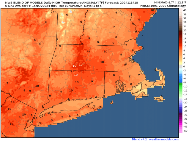
After a few chilly days, a warmup is in store for the weekend.

High pressure will keep us dry for the next few days, but that doesn’t mean it’s a simple forecast. A weak system passing well to our south and west tonight will spread some high clouds in, which will be just enough to keep us from getting as cold as last night. As that system pulls away on Friday, a bigger storm moving into Atlantic Canada will start to drift westward, sending more clouds our way during the afternoon, and these will be a little thicker, especially along the coast. However, we’ll also start to warm up as the airmass begins to moderate. The clouds start to move out on Saturday as upper-level high pressure builds in, with developing sunshine and milder temperatures. On Sunday, we flip things around with sunshine in the morning, then clouds start to move back in during the afternoon as a weak disturbance approaches from the west. It may produce a few widely scattered showers as it moves through on Monday, but this is far from the drought-buster that we desperately need.

Thursday night: Partly cloudy. Low 24-31, a little milder across Cape Cod.
Friday: Becoming sunny in the morning, clouds start to move back in by late in the day. High 49-56.
Friday night: Partly cloudy. Low 35-42.
Saturday: Morning clouds, especially near the coast, then becoming sunny again, breezy. High 54-61.
Saturday night: Clear skies. Low 36-43.
Sunday: Sunny through the morning, clouds start to move back in during the afternoon. High 54-61.
Sunday night: Becoming mostly cloudy. Low 36-43.
Monday: Morning clouds, possibly a shower, some afternoon clearing. High 56-63.