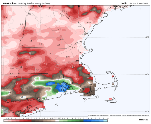
Little rainfall is expected this week, which means drought conditions will continue to worsen across the region.
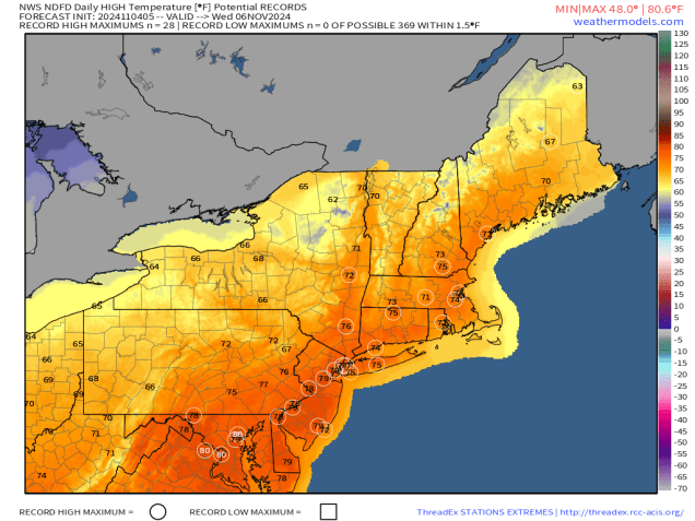
High pressure slides offshore today and a warm front heads toward the region. Clouds will increase and thicken up during the day ahead of the front, but only a few widely scattered showers will accompany the front tonight. Temperatures will rise tonight behind the front, with a couple of unseasonably warm days likely once again for Tuesday and Wednesday, with temperatures topping 70 in many areas , especially on Wednesday. A cold front will cross the region Wednesday night, accompanied by little to no rainfall once again. High pressure builds in for Thursday and Friday with cooler conditions, though temperatures will remain above normal for early November. Another cold front moves through Friday night with little fanfare, but even cooler weather follows for the weekend as high pressure builds back in. Clouds will start to move back in by late Sunday ahead of yet another system that will move in for the start of next week.
Monday: Sunshine filtered through high clouds, but they’ll thicken up late in the day. High 49-56.
Monday night: Mostly cloudy, slight chance for a shower. Low 43-50 in the evening, temperatures start to rise overnight.
Tuesday: Morning clouds, becoming partly sunny, breezy, and warmer. High 64-71.
Tuesday night: Clear to partly cloudy, breezy. Low 55-62.
Wednesday: A mix of sun and clouds, breezy, slight chance for a shower at night. High 69-76, a little cooler across Cape Cod.
Thursday: Mostly sunny, not as warm. High 59-66.
Friday: Sunshine and a few clouds, breezy. High 56-63.
Saturday: Mostly sunny and cooler. High 50-57.
Sunday: Morning sunshine fades behind increasing afternoon clouds, showers possible at night. High 52-59.
