Turkey Day is looking wet, but after that things will turn colder around here.

Low pressure will move out of the Tennessee Valley tonight and head towards Southern New England, passing near or just south of the South Coast on Thanksgiving Day. For most of us, we’ll see rain developing around daybreak, and ending in the evening, but across the hills from Worcester County into the Monadnocks of southwestern New Hampshire, some snow is likely, with a few inches possible. Across the rest of southern New Hampshire, we may see the rain start as snow in the morning, but it should quickly change to rain, with little to no accumulation. Farther north, especially north of Concord, NH, a few inches may accumulate, before a change to rain occurs. The system starts to pull away Thursday evening, with the rain ending before midnight, though we could see some flakes mix in as the rain winds down.
As the storm moves into Atlantic Canada, we’ll clear out for Friday with breezy and colder conditions. A few stray rain or snow showers are possible, especially across Cape Cod where the winds blowing over the still relatively mild water may generate some ocean-effect showers. Another weak disturbance moves through Friday night with just a few flurries, then even colder air settles in for the weekend and Monday. With an upper-level low over the Northeast and disturbances rotating around it, we could see a few widely scattered flurries or snow showers each day.

Wednesday night: Becoming cloudy, rain may develop towards daybreak, mixed with snow well north and west of Boston. Low 29-36, temperatures may start to rise after midnight.
Thursday: Periods of rain, mixed with snow in the morning, especially from the hills of Worcester County into southern New Hampshire, becoming breezy along the coast. High 39-46 north and west of I-95 47-54 south and east of I-95.
Thursday night: Rain ending before midnight, possibly mixed with some wet snow, some clearing late at night, breezy along the coast during the evening. Low 30-37.
Friday: Partly to mostly sunny. High 40-47.
Friday night: Clear to partly cloudy, chance for a few rain or snow showers across Cape Cod. Low 25-32.
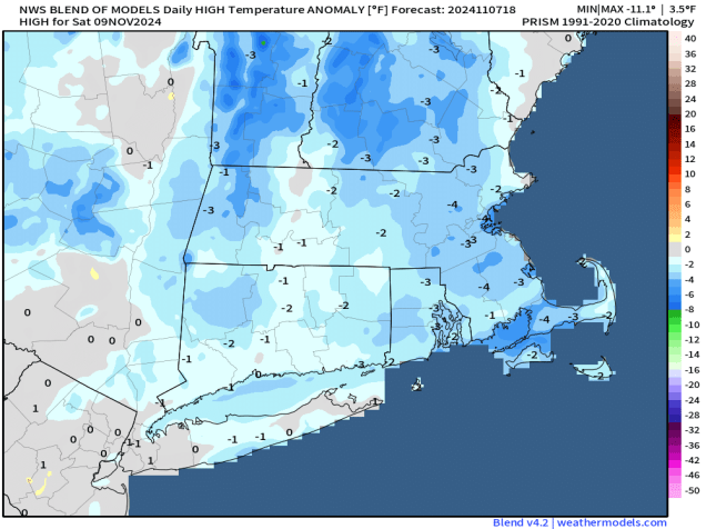
Saturday: Sunshine and some afternoon clouds, slight chance for a few flurries, especially across the Outer Cape, breezy, colder. High 37-44.
Saturday night: Partly cloudy. Low 22-29.
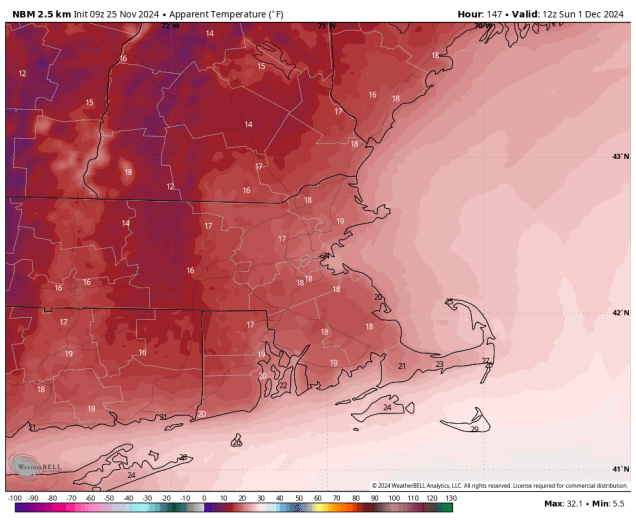
Sunday: A mix of sun and clouds, chance for a few flurries, breezy, chilly. High 35-42.
Sunday night: Clear skies. Low 20-27.
Monday: Partly to mostly sunny. High 34-41.