Temperatures will be riding a rollercoaster this week, but we’re still not expecting much rain.

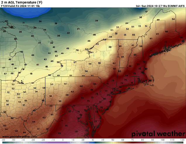
The week starts off with a rather chilly day as high pressure settles in. Despite sunshine, temperatures will only get into the 50s for most spots, and some may not even get that warm. As the high moves overhead tonight, we’ll have clear skies and light winds – a perfect recipe for radiational cooling. Some high clouds may start to move in overnight, which would slow the temperature fall. Temperatures should drop below freezing for much of the region, except possibly the urban areas and some spots across Cape Cod. If you’ve still got a few plants outside, it’s time to bring them in. The high slides off to the east on Tuesday, allowing temperatures to start to moderate a bit. Clouds move in late in the day ahead of a warm front. That warm front may bring in a few showers Tuesday night, but they shouldn’t be that widespread or heavy. Behind it, much milder weather returns for Wednesday and Thursday. Despite some clouds, temperatures will likely top 70 again in many locations on Halloween, and possibly even 80, which will make for some rather nice trick-or-treating weather Thursday evening, and possibly set a few records as well. Another cold front will move in early Friday, again with only a few showers accompanying it. Temperatures look like they’ll be quite mild in the morning, but cooler air moves in behind it during the afternoon. If the front comes in even later than we’re currently thinking, then we could see many places get well into the 70s again on Friday. High pressure returns for next weekend with much cooler air once again.
Don’t forget – Daylight Saving Time ends Sunday at 2am, when the clocks go back one hour. So, the good news is that you get an extra hour of sleep Saturday night. The bad news? Sunset next Sunday is at 4:34pm.

Monday: Sunshine and a few clouds. High 48-55.
Monday night: Clear through the evening, some high clouds may start to drift in after midnight. Low 27-34, a little milder across the Outer Cape and in urban areas.
Tuesday: Increasing and thickening clouds. High 52-59.
Tuesday night: Mostly cloudy, chance for some widely scattered showers. Low 46-53 during the evening, temperatures may start to rise a bit after midnight.
Wednesday: Becoming partly sunny, breezy, and warmer. High 67-74, a little cooler across Cape Cod.
Thursday: Partly sunny, breezy, and very warm. High 72-79, a little cooler across Cape Cod.
Friday: Some morning showers, some clearing in the afternoon, breezy. High 63-70.
Saturday: Mostly sunny, cooler. High 49-56.
Sunday: Sunny in the morning, clouds start to move back in during the afternoon. High 53-60.
