Astronomical summer ends this weekend and so does our extended stretch of dry and warm weather.
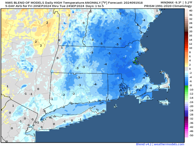
In the big picture, the forecast for the next few days is fairly simple, but the details aren’t so simple. An area of low pressure will meander around south of New England for the next few days while high pressure remains in place to the north. In between the two, we’ll have increasing northeasterly winds, bringing cooler air into the region. The big question is in regards to the shield of rain around the low pressure system, and how far inland it penetrates. The computer models all have varying ideas on this, so they don’t provide a lot of help in this case, so we’re relying on past experience and gut feeling for the most part. The best chance for rain will obviously be closer to the system itself, which means Cape Cod, the Islands, and likely the South Coast and parts of southeastern Massachusetts. Farther north and west, chances decrease fairly rapidly, as dry air from the high pressure system will keep most of the moisture from reaching the ground. In fact, there’s a pretty good chance that it remains dry, especially once you get north and west of Interstate 495, and possibly Interstate 95. For the areas where we do expect rain, it will rain off and on at times from now into part of Saturday. None of the days will be a washout, and there will be extended periods of dry weather, especially as you head farther inland, but there will be some episodes of steadier and potentially heavier rain, especially on Cape Cod.

The system should start to pull away later Saturday, with gradual clearing on Sunday, which is the first day of Autumn. The Autumnal Equinox occurs at 8:43am Sunday, officially ending summer. While we should see some sunshine developing, temperatures will stay on the cool side, thanks to the northeast wind, with most of the region not getting out of the 60s. High pressure builds back in for Monday, with more dry and cool conditions.

Thursday night: Mostly cloudy with showers likely, favoring areas south of Boston, breezy. Low 57-64.
Friday: Cloudy and breezy with occasional showers and some periods of steadier rain, especially south of Boston. High 63-70.
Friday night: Plenty of clouds with more showers, again, favoring areas south of Boston, still breezy. Low 54-61.
Saturday: Mostly cloudy, a few more showers around, mostly in the morning, and again, mostly south of Boston, breezy near the coast. High 61-68.
Saturday night: Partly to mostly cloudy. Low 50-57, a little milder across Cape Cod.
Sunday: Skies gradually become partly to mostly sunny, with the most sunshine north and west of Boston, breezy again. High 61-68.
Sunday night: Clear to partly cloudy. Low 46-53, a little milder across Cape Cod.
Monday: A mix of sun and clouds. High 62-69.
