Most of the upcoming weekend will feature some rather nice weather for early September.

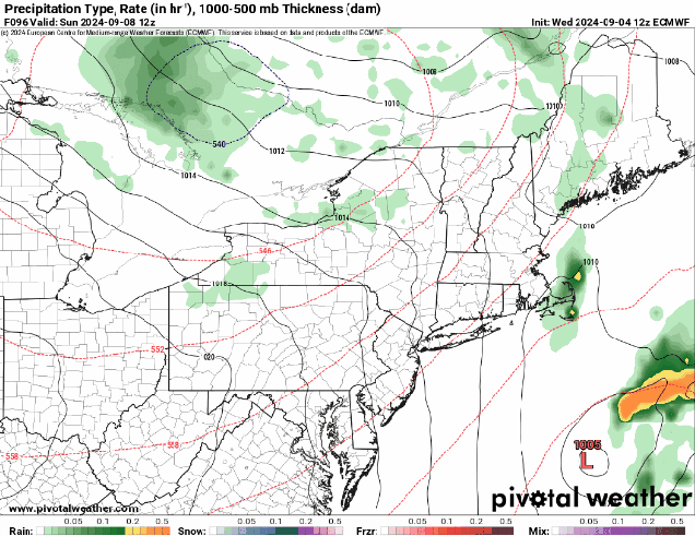
High pressure will move off to the east over the next few days, with dry weather continuing into a good chunk of Saturday. Plenty of sunshine is expected on Thursday with warm temperatures, but we’ll see some clouds start to move in on Friday. The clouds will be more numerous on Saturday as a frontal system moves in from the west and low pressure passes well offshore. Saturday looks to remain dry, with showers likely holding off until evening. Showers continue Saturday night, ending early Sunday as the cold front moves through, with clearing developing in the afternoon. High pressure returns on Monday with sunshine and cooler temperatures.
Wednesday night: Clear skies. Low 50-57.
Thursday: Plenty of sunshine. High 72-79.
Thursday night: Clear during the evening, some clouds start to move in overnight. Low 52-59.
Friday: A mix of sun and clouds. High 71-78.
Friday night: Partly to mostly cloudy. Low 54-61.
Saturday: Intervals of clouds and sunshine, showers possible late in the day. High 70-77.
Saturday night: Mostly cloudy with showers likely. Low 53-60.
Sunday: Any lingering showers end early followed by gradual clearing. High 69-76.
Sunday night: Clear skies. Low 48-55.
Monday: Lots of sunshine. High 69-76.
