The final week of August could feature some active weather, but Labor Day weekend may not be that bad.

We start the week off with what could be a very active day. A weak system will move across the region today, but with a warm and humid airmass present, and some cooler air aloft thanks to a nearby upper-level low pressure system, we’ve got the ingredients in place for showers and thunderstorms, some of which could be strong to severe this afternoon. Activity should begin to develop towards midday, and become more widespread and potent as it gets into our region. Some of the storms that develop could produce strong to damaging winds, hail, and heavy downpours. Once we get past sunset, activity should diminish and dissipate.

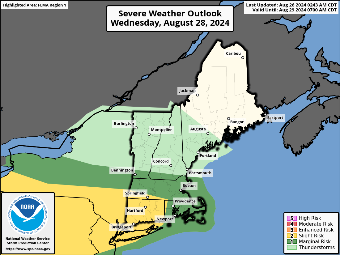
High pressure briefly builds in for Tuesday with some sunshine and mild temperatures, but it won’t last too long. Another cold front moves in on Wednesday. How warm we get will depend on the timing of the front, but the potential exists for a very warm and humid day, if the front holds off long enough. The front will be accompanied by showers and thunderstorms. Some of these storms could be strong, again depending on the timing of the front.
Once that front moves through, high pressure builds in with cooler and drier weather for Thursday and Friday. Another system will move in during the weekend with a few showers and thunderstorms possible late Saturday or early Sunday. Behind that front, high pressure returns with sunshine and warm temperatures later Sunday and Labor Day. Another cold front may move in late in the day on Labor Day, with a few showers or thunderstorms possible, but don’t go cancelling any plans just yet. We’ll have a better idea on the timing of that front when we get to our Weekend Outlook on Thursday.

Monday: A little fog early, otherwise some morning sun, then clouds move in with showers and thunderstorms develop, some could be strong to severe. High 74-81.
Monday night: Showers and storms end in the evening, becoming partly cloudy, patchy fog develops. Low 57-64.
Tuesday: Partly to mostly sunny. High 77-84.
Tuesday night: Clear during the evening, some clouds move in after midnight, showers possible toward daybreak. Low 61-68.
Wednesday: Mostly cloudy and humid with showers and thunderstorms likely. High 82-89.
Thursday: Morning clouds, then gradual clearing and less humid. High 68-75.
Friday: Partly to mostly sunny. High 69-76.
Saturday: More clouds than sun, chance for some late-day showers. High 73-80.
Sunday: Any showers end early, becoming partly sunny. High 76-83.
Labor Day: A mix of sun and clouds, chance for a late-day shower or thunderstorm. High 75-82.
