Ready or not, the first heat wave of the summer is on the way later this week.
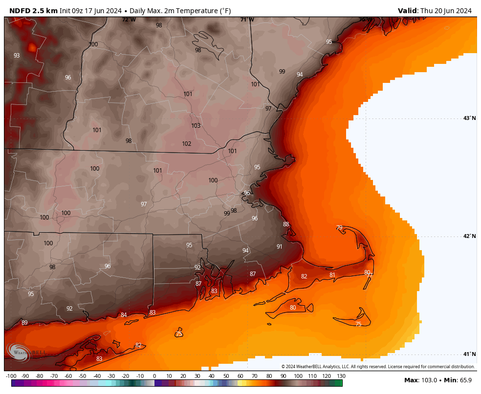
A warm front will cross the region today with just some clouds accompanying it, but little to no precipitation. Behind it, south to southwest winds will usher warmer and more humid air in, and it will remain in place for a good chunk of the week. High pressure building in both at the surface and aloft will result in partly to mostly sunny skies with hot and humid conditions from Tuesday into at least Thursday. The south winds will keep the South Coast and Cape Cod cooler, only in the 80s or even upper 70s, but inland temperatures will get well into the 90s, but when you factor in the humidity, it will feel like 95-105 degrees during the hottest part of the day each afternoon. Air temperatures could approach 100 both Wednesday and Thursday afternoon, especially from MetroWest into the Merrimack Valley, with some records possible. Excessive Heat Watches and Heat Advisories are already in effect for parts of the region from Tuesday afternoon into Friday evening. A few showers and thunderstorms may pop up each afternoon, especially Thursday, but they will be widely scattered, and only provide some relief in a few spots.
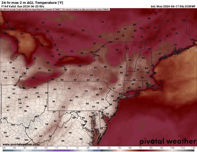
By the end of the week, a cold will start to drop down from the north, bringing more widespread showers and thunderstorms along with cooler weather, but when it moves through is still a question mark. Some models bring it down on Friday, have it lift back northward later Saturday, others have it move through on Friday, then not come back until early in the following week. This will obviously have a big impact on the temperature forecast, especially for the weekend. Some showers will likely accompany this front as waves of low pressure ride along it, but timing them is a fool’s errand at this point, because we’re not even sure yet when the front will move through.
Monday: A mix of sun and clouds, breezy during the afternoon. High 78-85, a little cooler near the South Coast.
Monday night: Clear to partly cloudy. Low 61-68.
Tuesday: Partly to mostly sunny. High 90-97, except 82-89 near the South Coast and 74-81 across the Cape and Islands.
Tuesday night: Clear to partly cloudy. Low 64-71.
Wednesday: Sunshine and a few clouds. High 93-100, except 85-92 near the South Coast and 77-84 across the Cape and Islands.
Thursday: Partly sunny. High 95-102, except 87-94 near the South Coast and 79-86 across the Cape and Islands.
Friday: Intervals of clouds and sun with some showers and thunderstorms possible. High 90-97, except 82-89 near the coast.
Saturday: Partly sunny, chance for an afternoon shower or thunderstorm. High 84-91, cooler near the coast.
Sunday: Intervals of clouds and sun, showers and thunderstorms possible. High 80-87, cooler near the coast.
