Our stretch of nice weather will continue for a few more days, but changes are coming.
A weak disturbance passes by early in the day with some clouds and possibly a stray shower or two, otherwise, high pressure remains in control today with mainly dry conditions, but a backdoor cold front will bring some cooler weather into eastern parts of the region during the afternoon. High pressure remains in control for Tuesday with more sunshine and seasonably warm temperatures, though a seabreeze will keep coastal areas cooler. Wednesday is when the transition starts. An upper-level low starts to move out of the Midwest, sending clouds in, but we’ll remain warm, though a seabreeze is likely at the coast once again. A warm front approaches Wednesday night with showers developing, possibly a period of steady rain early Thursday. A second disturbance follows for Thursday night into Friday with another round of showers possible. With the cloud cover and rainfall, temperatures will be cooler, but probably still close to normal for early June. As the upper-level low moves through on Saturday, some additional showers are likely, possibly lingering into Sunday as well, depending on how quickly the upper-level low pressure area moves away from the region.
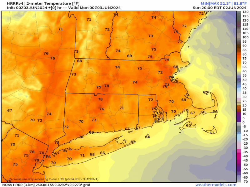
Monday: Slight chance for a morning shower, then becoming mostly sunny. High 79-86 inland, 71-78 along the coast but dropping in the afternoon.
Monday night: Partly cloudy. Low 50-57.
Tuesday: Sunshine and some afternoon clouds. High 65-72 along the coast, 73-80 inland.
Tuesday night: Partly cloudy. Low 52-59.
Wednesday: Partly sunny, rain may develop late in the day, more likely at night. High 77-84, cooler along the coast.
Thursday: Mostly cloudy with some showers possible, especially in the morning. High 69-76, coolest near the coast.
Friday: Intervals of clouds and sun, chance for a few showers. High 70-77.
Saturday: Partly sunny, chance for a few more showers. High 69-76.
Sunday: A mix of sun and clouds, slight chance for another shower. High 70-77.
