We’re into April, but it won’t feel like it. In fact, there may be some flaky white stuff coming for parts of the region, and that’s not an April Fool’s joke.

A weak low pressure system will pass south of the region today, bringing in some clouds, but only a few rain showers, mainly near the South Coast. However, that’s just the warmup act for what is to come. Another low pressure system will follow on Tuesday, again passing south of the region. This one will spread in a few more showers, again favoring areas closer to the South Coast, but a stronger system will move into the Great Lakes, producing some severe weather across the Ohio and Tennessee Valleys. This is the system that will impact us Wednesday into Thursday.

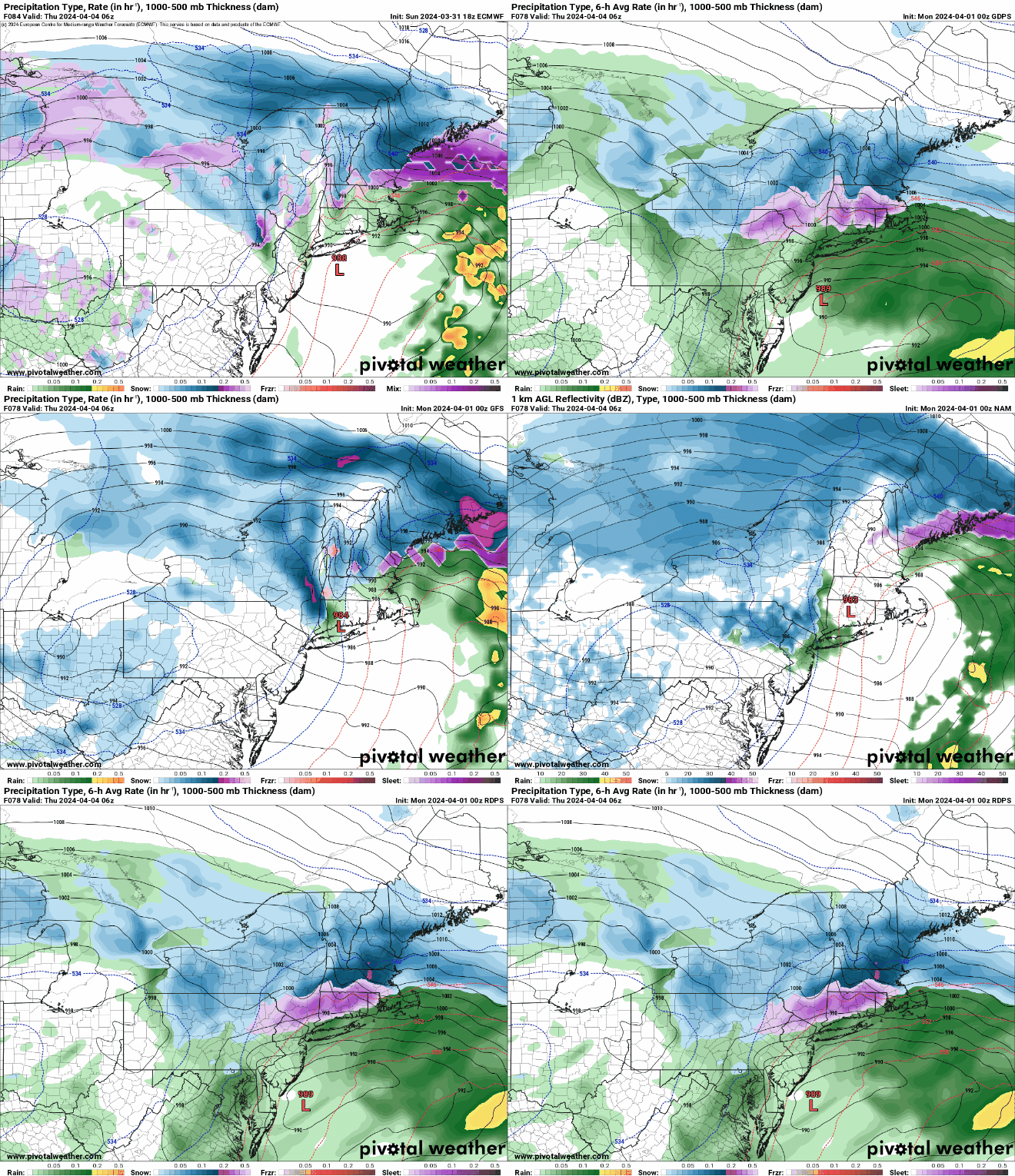
That system will slowly drift eastward spreading rain in during the day on Wednesday, some of which could be heavy. This will renew flooding concerns across the region. Meanwhile, a secondary area of low pressure will develop near the Mid-Atlantic states, heading northeastward while strengthening. This will bring more heavy rain in along with some gusty northeast winds. This could result in some coastal flooding along east-facing shorelines at high tide. This is also where the uncertainty starts to creep in. Whether the storm stays south of New England, passes close to the South Coast, or crosses Cape Cod, remains to be seen, but it will have an impact on the forecast. Why? As the system strengthens, it will drag cold air southward from Canada. We could see some snow mix in with the rain during the daytime on Wednesday, but with the sun angle getting higher and higher, and temperatures likely above freezing, it’ll have a very tough time accumulating unless it comes down fairly hard. Once the sunsets, accumulation will be a bit more likely, especially across the hills from Worcester County into the Monadnocks, but also across the lower elevations of the interior, where temperatures may drop close to freezing. This will depend on how far north the low actually travels. The farther north the low goes, the farther north you’ll need to be to see accumulating snow. While it’s still a little early for us to start talking about amounts, others have posted some of the model snow forecasts on the internet already. The problem is, these maps significantly overestimate the amount of snow that this storm will likely produce, due to the factors we listed above. We’ll likely post a more detailed look at this storm on Tuesday, when things should be a bit clearer.

Rain and snow showers should wind down on Thursday, but winds will remain gusty as the storm only slowly pulls away. An upper-level low pressure system will move in for Friday and Saturday, keeping the surface low pressure area nearby, resulting in breezy and chilly conditions, with a few more rain or snow showers possible. High pressure builds in for Sunday with drier and more seasonable conditions.

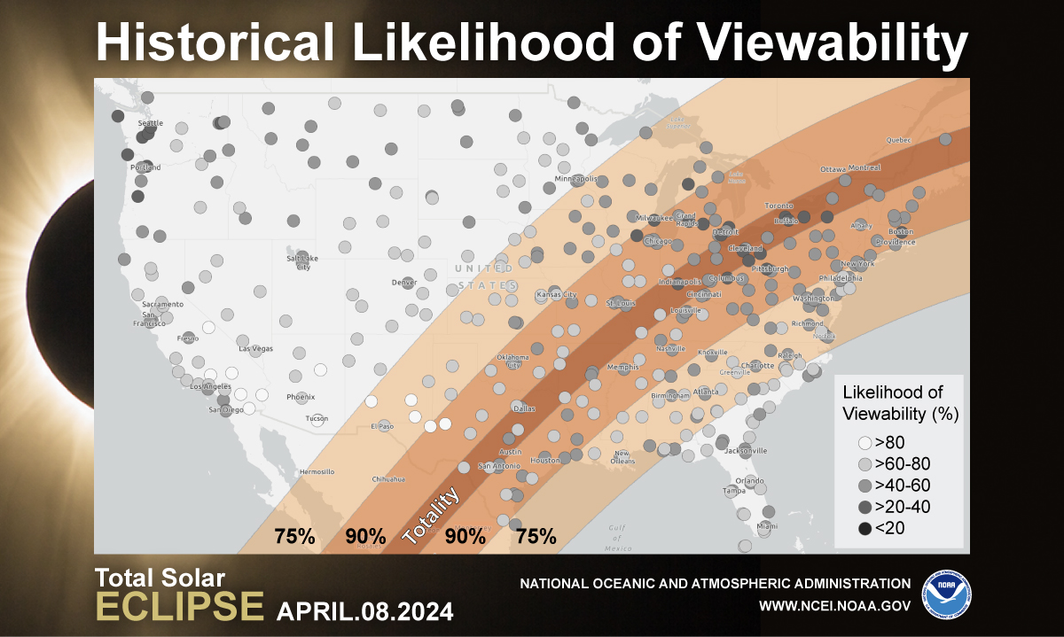
For the eclipse on Monday, right now, it looks like high pressure may provide the region with at least partially clear skies, but this can obviously change, so stay tuned for future updates. Tuesday is also an important day, as it is the home opener at Fenway for the Red Sox. Right now it looks sunny, but a seabreeze is likely, so even though temperatures could get well into the 50s and 60s inland, closer to the coast, temperatures may only be in the upper 40s or lower 50s. Obviously this can change as well.

Monday: Partly to mostly cloudy, chance for a few showers, mainly near the South Coast. High 51-58, a little cooler along the coast.
Monday night: Mostly cloudy. Low 34-41.
Tuesday: Cloudy with rain developing late in the day, mainly south of the Mass Pike. High 43-50, coolest along the coast.
Tuesday night: Periods of rain and showers spreading across the region, possibly mixed with or changing to sleet and/or snow from the Worcester Hills into the Monadnocks of southern New Hampshire, becoming breezy. Low 33-40.
Wednesday: Windy with rain, heavy at times, possibly mixed with a little sleet or snow at times inland and in the hills, especially at night. High 36-43.
Thursday: Windy with rain or snow showers gradually winding down. High 37-44, possibly warmer across southeastern Massachusetts
Friday: Cloudy and breezy with a few showers, possibly some snow showers. High 39-46.
Saturday: Mostly cloudy with some additional showers, breezy. High 40-47.
Sunday: A mix of sun and clouds, still breezy. High 47-54.