Tuesday is looking like a snowy day, but perhaps not as bad as we were thinking earlier, for at least part of the region.

The general ideas we talked about in our Weekly Outlook earlier today are still valid. Low pressure is moving across the Tennessee Valley this afternoon and will redevelop near the Mid-Atlantic coastline later today, passing south of New England on Tuesday as it intensifies. However, some of the finer details have changed a bit. For one, the timing of the snow has been altered slightly. The snow should develop across the region near or a little before daybreak, and it may fall heavy at times for a while during the late morning and early afternoon, but now it looks like it will be winding down by late-afternoon, ending completely around the evening rush hour. This is a little faster than we were thinking earlier.
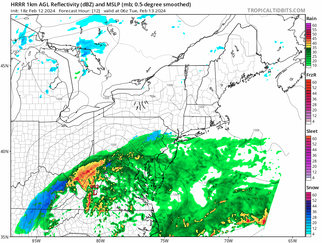
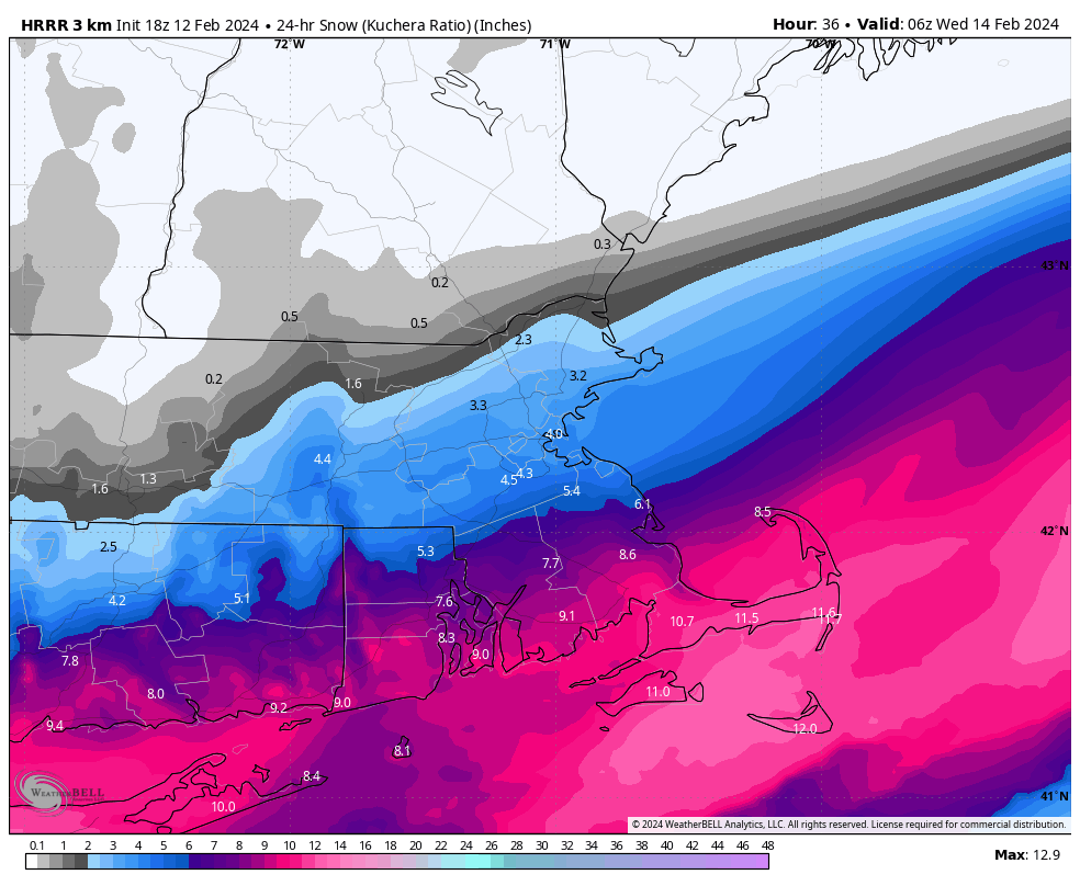
It also looks like the storm will be a little farther south than we were thinking. This has significant implications for the snowfall forecast. This shifts the area of heaviest snow a little farther south. The bigger change is on the northern fringe of the snowfall. We had talked about the fact that the models were showing a sharp cutoff to the snow, and you could go from little to nothing to well over 6 inches in the span of 20 miles. That is still the case, but instead of that being over central or southern New Hampshire as we thought overnight, it’s now looking like that could be across southern New Hampshire or the Merrimack Valley. So, how much are we expecting now?
Central/Southern NH: 1″ or less
Merrimack Valley: 1-4″
MetroWest/Metro Boston/North Shore: 3-6″
Southeastern Massachusetts/Rhode Island: 4-8″
Cape Cod and the Islands: 6-10″ (possibly less Outer Cape/Islands with some rain to start)
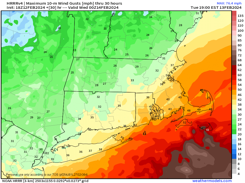
The other aspects of the storm that we mentioned – strong winds and coastal flooding, have not changed. A High Wind Warning is in effect across Cape Cod, where sustained winds of 20-30 mph are expected, with gusts to 50 mph possible. The rest of the region is looking at gusts of 25-35 mph, with some stronger gusts, especially near the coast. Along the coast, flooding is possible around high tide, especially in the areas that are normally prone to flooding.
We’re also still keeping an eye on the potential for more light snow Thursday night and again on Saturday with two additional storm systems. More on that later in the week.
