It took until mid-January, but this week will finally feel like winter around here.
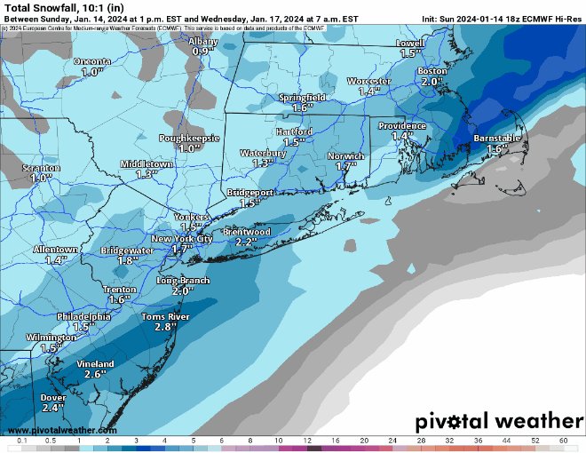
The week starts off with high pressure providing the region with sunshine and chilly temperatures. Low pressure will start to organize across the Southeast and begin heading up the East Coast, spreading some clouds in during the afternoon and evening. While that system is heading our way, an upper-level disturbance will move toward the region from the Midwest. If these two systems were to come together, we could have quite the snowstorm on our hands…but that’s not going to happen. Instead, we’ll have the coastal low pass well south and east of New England while the upper-level disturbance moves through. The result will be a period of light snow developing toward midday Tuesday, ending before midnight. Most places will pick up 1-3 inches of snow, possibly a little more in spots, possibly a little less across parts of Cape Cod and the Islands where a little rain could mix in.
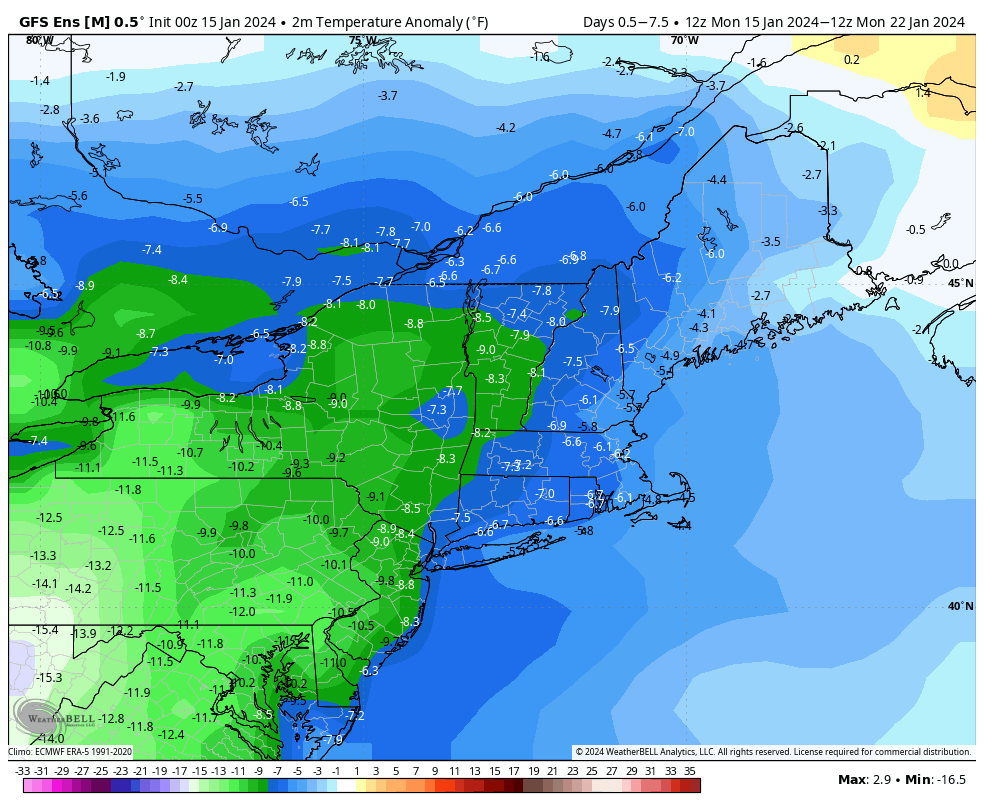
High pressure builds in behind the system with dry and chilly conditions for Wednesday and Thursday, though not nearly to the magnitude of what they have been experiencing from the Midwest into the Northern Rockies. Clouds start to stream in on Thursday as a scenario similar to Tuesday unfolds. Low pressure passes south and east of New England on Friday while an upper-level low moves in, resulting in another round of light snow. Much like Tuesday, it looks like just a few inches for most places, though we’re not expecting any rain across the Cape and Islands this time. As that system pulls away, Saturday is shaping up to be quite a chilly day with high pressure building in, likely the coldest one so far this winter, with some places struggling to reach 20 degrees in the afternoon. Sunday looks dry as well with high pressure still in control, but not as chilly as Saturday.

Monday: Sunny in the morning, clouds start to move in during the afternoon. High 27-34.
Monday night: Becoming cloudy. Low 18-25, temperatures may start to rise after midnight.
Tuesday: Cloudy with light snow likely. High 28-35, possibly warmer across Cape Cod.
Tuesday night: Clearing. Low 14-21.
Wednesday: Sunshine and a few clouds, colder. High 24-31.
Thursday: Increasing clouds, breezy. High 25-32.
Friday: Cloudy and breezy with light snow likely. High 26-33.
Saturday: Partly sunny, windy, and cold. High 17-24.
Sunday: Mostly sunny, breezy. High 21-28.
