Lots of change is in the air for the weekend, from warm to cool, from wet to dry, from windy to calm.
High pressure is in control to start the weekend with dry weather for tonight and Friday. Temperatures will turn milder as winds shift into the southwest with the high pressure area moving off to our east. However, clouds will be streaming in ahead of both an approaching cold front and a low pressure area moving up the East Coast. The low pressure area is the one that has been drenching Florida for the past couple of days, but right now, it looks like it will stay far enough offshore to only bring in some rain to parts of Cape Cod and the Islands and possibly southeastern Massachusetts. However, the cold front will also bring in some showers for Friday night into Saturday morning. Saturday will start off quite mild, likely in the 50s for most spots, but with the front moving through, not only will it bring an end to the rain, it will usher much cooler weather in on gusty northwest winds. Temperatures will likely drop trough the afternoon, with skies clearing out late in the day. High pressure builds in for Sunday and Monday with sunshine and cool conditions, but it will likely remain breezy, especially on Sunday, as low pressure strengthens in Atlantic Canada.

Thursday night: Clear skies through the evening, clouds start to move in after midnight. Low 34-41.
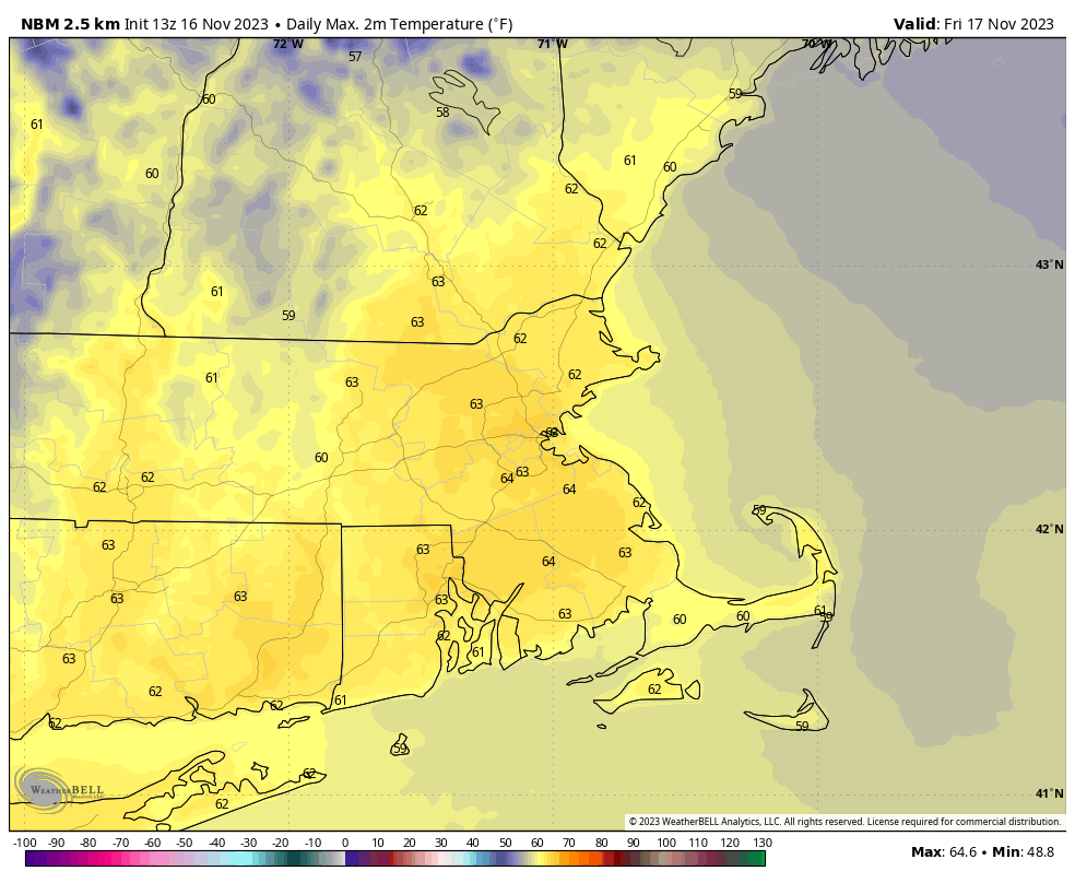
Friday: Increasing and thickening clouds, breezy, and mild. High 58-65.
Friday night: Cloudy with showers developing, mainly after midnight. Low 47-54.
Saturday: Rain and showers end by early afternoon, skies start to clear out late in the day, becoming breezy and turning cooler in the afternoon. High 52-59 in the morning, temperatures drop in the afternoon.
Saturday night: Clear skies, breezy during the evening. Low 28-35.
Sunday: Plenty of sunshine, breezy. High 44-51.
Sunday night: Clear skies, breezy. Low 25-32.
Monday: Sunshine and a few clouds, still a bit breezy. High 38-45.
