Another rainy Saturday? Yup, we’ve got another rainy Saturday on the way.
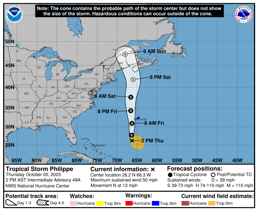
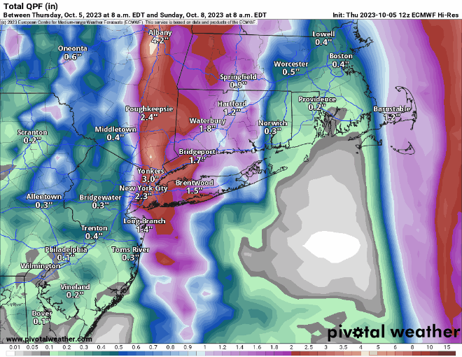
We start off with another foggy night tonight, with plenty of moisture around and high pressure sliding off to the east. Once the fog burns off Friday morning, we’ll still have plenty of clouds ahead of a cold front slowing moving in from the west. A few showers are possible during the day, but they’ll become more likely at night, and through a good chunk of the day on Saturday. Complicating matters is Tropical Storm Philippe, or what’s left of it. It will be moving northward, passing east of the region, but some of the rain from it could move into eastern Massachusetts. Eventually, it’ll get tugged northwestward by an upper-level low (more on that in a minute), moving into Maine or New Brunswick this weekend, with some heavy rain and gusty winds for parts of northern New England. The cold front moves across the region Saturday evening, bringing an end to the rain, then much cooler air settles in behind it. However, that upper-level low over southeastern Canada will move southeastward, which means that despite high pressure building in at the surface, we’ll still have plenty of clouds around Sunday and Monday, with a few popup showers possible.
Thursday night: Becoming mostly cloudy with areas of fog, some of it dense. Low 54-61.
Friday: Partly to mostly cloudy with a chance for a shower or two. High 67-74.
Friday night: Cloudy with showers developing. Low 57-64.
Saturday: Periods of rain and showers. High 61-68.
Saturday night: Showers end, some clearing possible late at night, becoming breezy. Low 46-53.
Sunday: A mix of sun and clouds, windy, cooler. High 57-64.
Sunday night: Clear to partly cloudy, winds slowly diminish. Low 41-48.
Monday: Partly sunny, breezy. High 54-61.
