Lee and Margot both remain hurricanes over the Atlantic this afternoon, but the future of both is a little more certain than it had been just a few days ago.
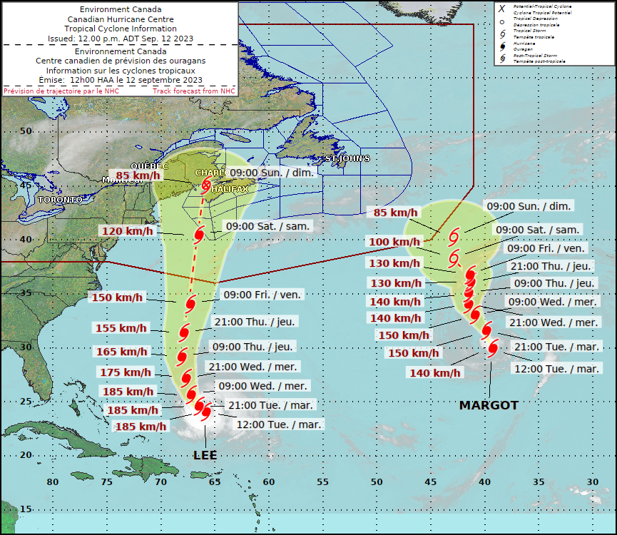
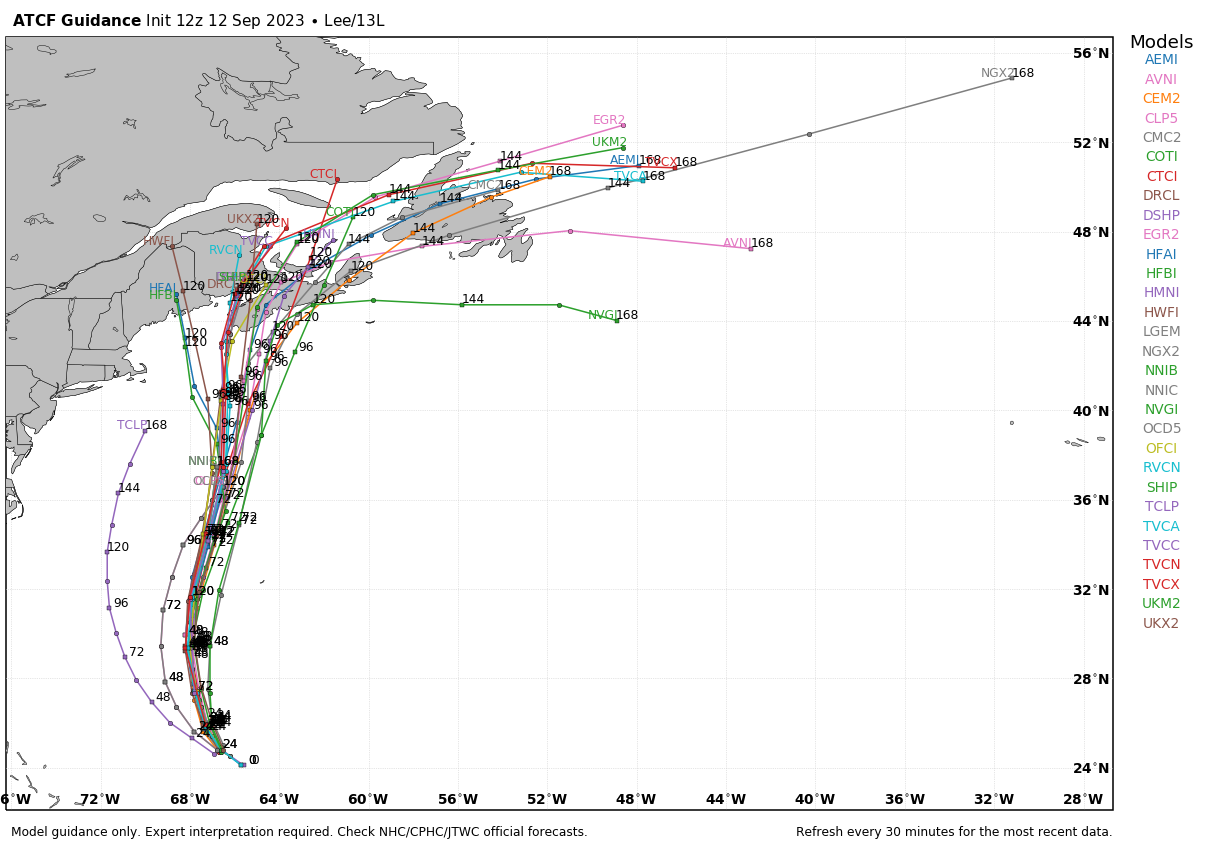
As of 11am, Hurricane Lee was centered about 555 miles south of Bermuda moving toward the west-northwest at 6 mph. Maximum sustained winds were near 115 mph. Lee is expected to turn more toward the northwest and eventually north over the next day or so as it reaches the western edge of a ridge of high pressure. This will bring the storm west of Bermuda, but because it is relatively large, strong winds will likely impact the island later Thursday and early Friday, a Tropical Storm Watch has been issued. Sustained winds of 40-50 mph are expected, with some gusts to 70 mph.

Lee will steadily weaken beginning Wednesday as it starts to move over cooler water and also feels the impacts of increasing wind shear. It should continue northward for the next few days, likely starting to transition into an extratropical system by later Friday. While the storm will be weakening, likely down to tropical storm strength, the wind field will be expanding, as it becomes an extratropical system. There is still one bit of uncertainty with the track. Another upper–level trough of low pressure will be moving into the Northeast. Will this pull Lee northwestward for a time on Friday, keep it heading northward toward Nova Scotia, or turn it more toward the northeast. Either way, Nova Scotia and nearby New Brunswick are likely to bear the brunt of Lee, with strong winds, heavy rain, and rough surf with some coastal erosion. Gusty winds and heavy rain are also likely across parts of eastern Maine, but here in southern New England, aside from the rough surf that we’ll have most of the week, impacts will be limited to gusty winds and some rain, mainly right along the coast, especially across Cape Cod. Sustained winds of 20-40 mph gusting to 60 mph at times are possible across the Outer Cape and Nantucket.
Well to the east we have Hurricane Margot. As of 11am, Margot was centered about 890 miles southwest of the Azores, moving toward the north at 12 mph. Maximum sustained winds were near 85 mph. Margot may strengthen a bit more over the next day or so, but after that, a steady weakening trend should commence. Margot will continue northward for the next couple of days, but after that, steering currents will become a bit weaker, so Margot’s future is a little more uncertain. It is not a threat to any land areas at this time, so whether it continues northward or turns a bit more toward the northwest, it will only impact shipping interests and marine life.

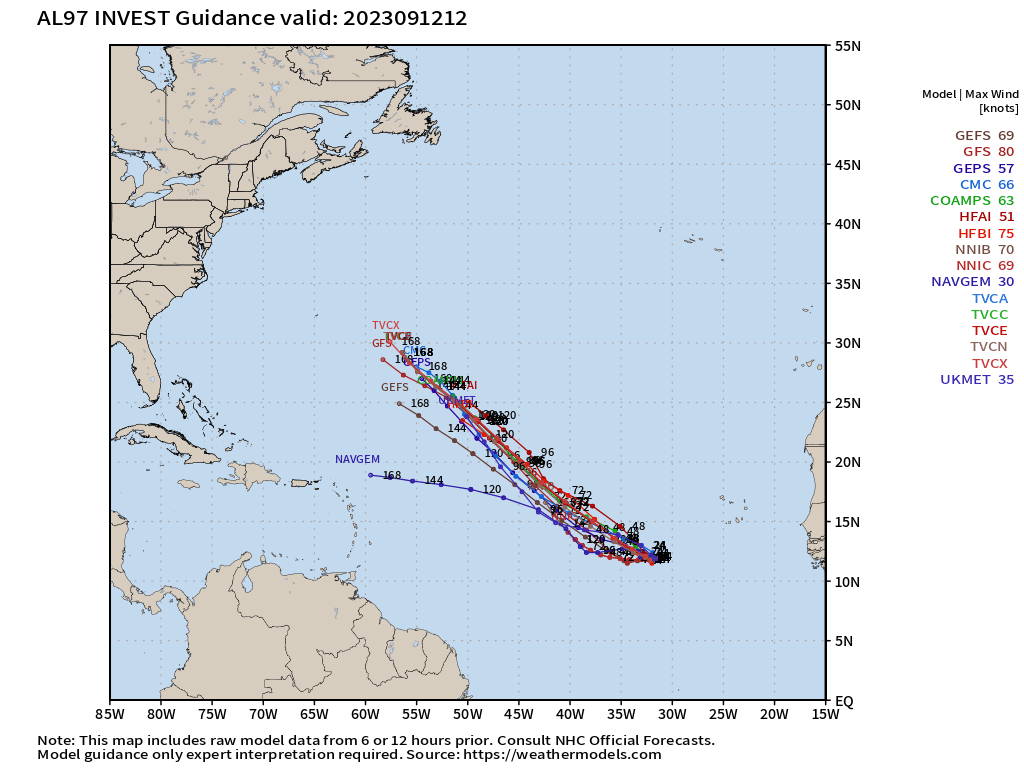
We’re also keeping an eye on an area of disturbed weather located over the eastern Atlantic ocean. It’s producing disorganized showers and thunderstorms right now, but conditions could be favorable for some development over the next few days. If it continues to develop, it could spawn a tropical depression by this weekend. It is not a threat to any land areas at this time, and most of the forecast models show it heading northwestward into the open Atlantic.
Elsewhere, the tropics remain quiet, with no active systems anywhere in Pacific, and none expected for the next several days.
