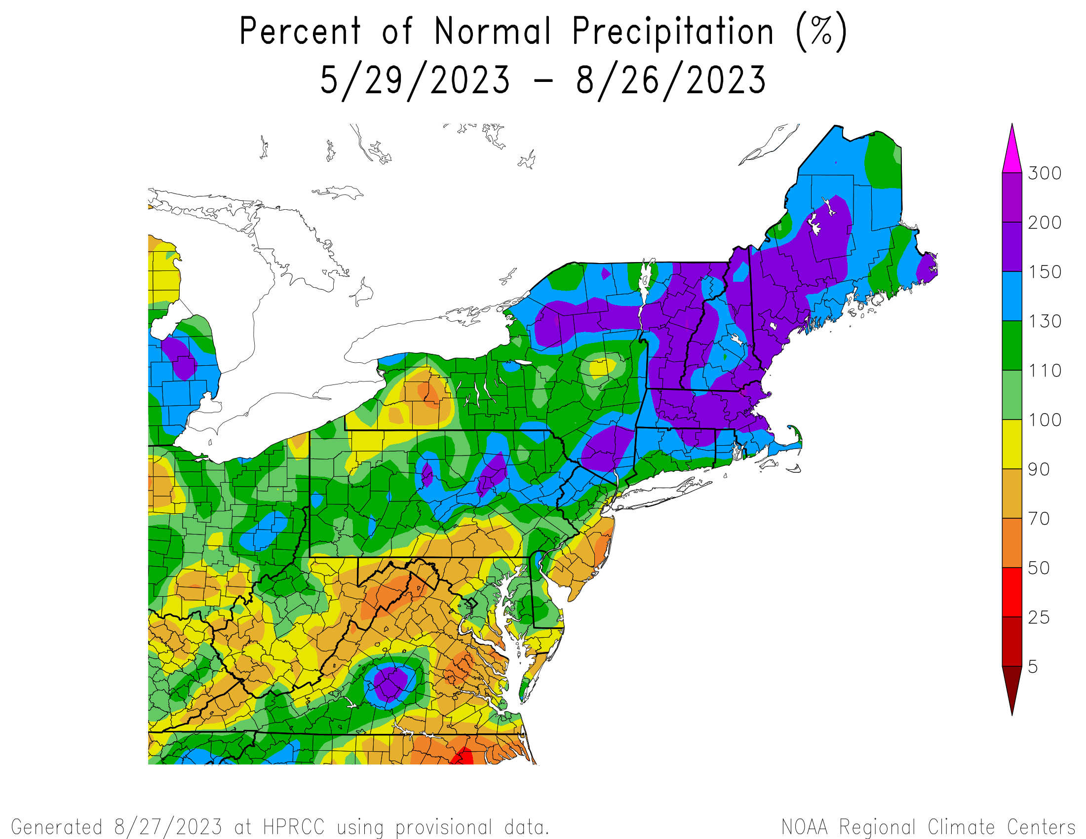
The final days of meteorological summer feature more rain, which is pretty much keeping to the theme we had all summer.
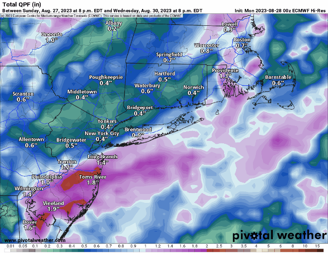
The week starts off with a rather complex forecast, but today should be mainly dry with high pressure moving offshore. With the high centered mainly north and then east of us, we’ll have onshore winds, keeping temperatures on the cooler side of normal near the coastline. Moisture will begin streaming northward in the form of high clouds today, though they will thicken up and lower later in the day. Here’s where things start to get complicated. A frontal system is currently stalled out across the Southeast, it will gradually lift northward tonight and Tuesday, allowing some tropical moisture to follow. As moisture rides northward along the front, some rain is expected to move in late tonight and Tuesday, especially across southeastern New England. Some of this rain could be quite heavy, but how far north and west the rain shield extends, and how far northward the heavy rain gets is still a question mark. Right now, it looks like it’ll be mainly across the South Coast and parts of southeastern Massachusetts, but that is obviously subject to change. At the same time, we’ll also have another cold front approaching from the northwest. We’ll also be keeping a close eye on Hurricane Franklin well offshore and Tropical Storm (possibly Hurricane) Idalia in the Gulf of Mexico (more on these two below). Franklin will be helping to push the front to our south northward, while the other front moves in from the west. In between, we’ll have another round of showers and thunderstorms on Wednesday, especially during the morning hours, before the approaching front finally moves through the region. Again, some heavy rain is possible in spots, but probably not with coverage or intensity expected across the South Coast on Tuesday.
High pressure builds in behind the cold front for Wednesday night, and remains in place into the weekend, keeping us mostly on the dry side, with temperatures starting cool, but gradually warming up as we get to the weekend. There is a potential fly in that ointment though. Idalia is expected to make landfall near the Big Bend area of Florida Tuesday night or early Wednesday, then head into the Carolinas and offshore on Thursday. The high building in here should block its northward progress and steer it out to sea well to our south. However, if the timing is off a bit, say Idalia slows down and makes landfall later than currently expected, then perhaps some of the moisture from it or its remnants ends up being dragged farther north, and ruins our forecast of drier weather into Labor Day Weekend. While this isn’t likely right now, it’s several days away, and things can change quickly, especially when tropical systems are involved. Either way, between Franklin and Idalia, we’ll have some rough surf across the beaches and coastal waters for much of the upcoming week, so keep that in mind if that’s where your plans bring you.

By the weekend and into Labor Day, another cold front will approach the region, but aside from a few showers as it moves in on Sunday, it looks to remain mostly dry and warm.
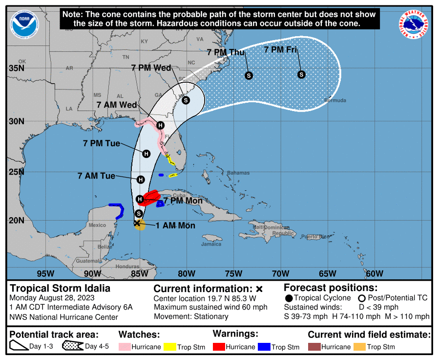
As for the tropics, here’s the latest on our two named systems:

Hurricane Franklin was centered about 530 miles southwest of Bermuda as of 11pm Sunday, moving toward the north-northwest at 8 mph. Maximum sustained winds were near 105 mph. Franklin continues to get better organized and will continue to strengthen for another day or two as it heads northward and then northeastward over warm waters. While it will pass west and northwest of Bermuda late Tuesday and Wednesday, it will likely be close enough to produce tropical storm conditions on the island, with some locally heavy showers, and winds gusting upwards of 40-60 mph. A Tropical Storm Watch will likely be issued for Bermuda on Monday. After that, Franklin will likely head northeastward out into the open Atlantic while gradually losing tropical characteristics.

Meanwhile, Tropical Storm Idalia formed on Sunday in the northwestern Caribbean Sea. As of 2am Monday, it was centered about 150 miles south of the western tip of Cuba and barely moving. Maximum sustained winds were up to 60 mph. The forecast for Idalia calls for it to start heading northward, passing close to or across extreme western Cuba on Monday before heading into the eastern Gulf of Mexico. Steady strengthening is expected, and Idalia will likely become a hurricane on Monday. Once into the Gulf, the water is very warm, and the warm water extends rather deeply under the surface, which is one of the main ingredients that feeds tropical systems. While the upper-level environment may not be perfect, the potential is there for Idalia to rapidly strengthen on Monday and Tuesday, possibly into a major hurricane as it approaches the Gulf Coast of Florida. Eventually it will start turning more toward the northeast, but when that turn occurs will be crucial for pinpointing landfall. A Hurricane Watch is in effect for the Florida Gulf Coast from Englewood to Indian Pass, which includes the Tampa Bay area. Once inland, it will start to weaken, but it should start to turn more toward the east-northeast and eventually east, as the high building in up here should block its northward progress. How quick that turn occurs will determine how long it stays over land before moving into the Atlantic, which in turn will determine how strong it still is when it reaches the Atlantic, if it survives that long. We’ll have a much more detailed post about the tropics on Tuesday as Idalia nears the Gulf Coast and Franklin makes its closest pass to Bermuda.
Monday: Partly to mostly sunny in the morning after some patchy fog burns off, clouds increase and thicken in the afternoon. High 73-80.
Monday night: Mostly cloudy, showers developing near the South Coast, Cape, and Islands late at night. Low 58-65.
Tuesday: Mostly cloudy with showers likely, possibly a thunderstorm, except some locally heavy rain and thunderstorms possible across parts of Rhode Island, southeastern Massachusetts, Cape Cod, and Islands. High 71-78.
Tuesday night: Cloudy with scattered showers, possibly a rumble of thunder. Low 61-68.
Wednesday: Cloudy with more showers, possibly a thunderstorm, ending in the afternoon, followed by clearing in the evening. High 72-79.
Thursday: Sunshine and a few clouds, breezy. High 69-76.
Friday: Plenty of sunshine. High 72-79.
Saturday: Sunshine and some afternoon clouds. High 74-81.
Sunday: A mix of sun and clouds, breezy, chance for a shower. High 75-82.
Labor Day: Partly to mostly sunny. High 77-84.
