An active weather pattern is expected for the next few days with several chances of rain.
A low pressure system will move across the region this evening, with some showers and thunderstorms likely. A few of the storms could produce some heavy rain, and there is a very low risk for some severe storms, mainly near the South Coast. We could see some brief spinups that may result in a weak tornado, similar to what we saw on Tuesday.
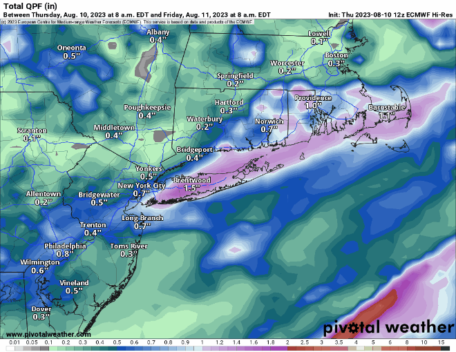
The rain winds down around midnight, then skies clear out as high pressure builds in, setting up a fantastic Friday with sunshine, seasonably warm temperatures, and low humidity. Clouds stream back in on Saturday ahead of the next system. This one will be moving along quickly, but it will likely bring in some showers and thunderstorms Saturday night into Sunday morning. We’ll clear out behind that system Sunday afternoon, but another one quickly follows for Monday. Most of Monday should remain dry, but showers and thunderstorms may develop late in the day. They’ll be more likely at night and into Tuesday, with some heavy rain possible once again.

Thursday night: Showers and thunderstorms likely this evening, skies start to clear out after midnight. Low 60-67.
Friday: Sunshine and a few afternoon clouds, breezy. High 76-83.
Friday night: Clear skies. Low 56-63.
Saturday: Morning sun, increasing afternoon clouds. High 79-86.
Saturday night: Partly to mostly cloudy with some showers and thunderstorms likely. Low 64-71.
Sunday: Showers end early, clearing during the afternoon, breezy. High 79-86.
Sunday night: Clear to partly cloudy. Low 58-65.
Monday: Sunny in the morning, clouds return in the afternoon with a chance for showers and thunderstorms late in the day. High 77-84.
