We’ve got a little bit of everything this weekend – severe weather, heat and humidity, and a return to cooler and drier weather. Let’s get right to the details.

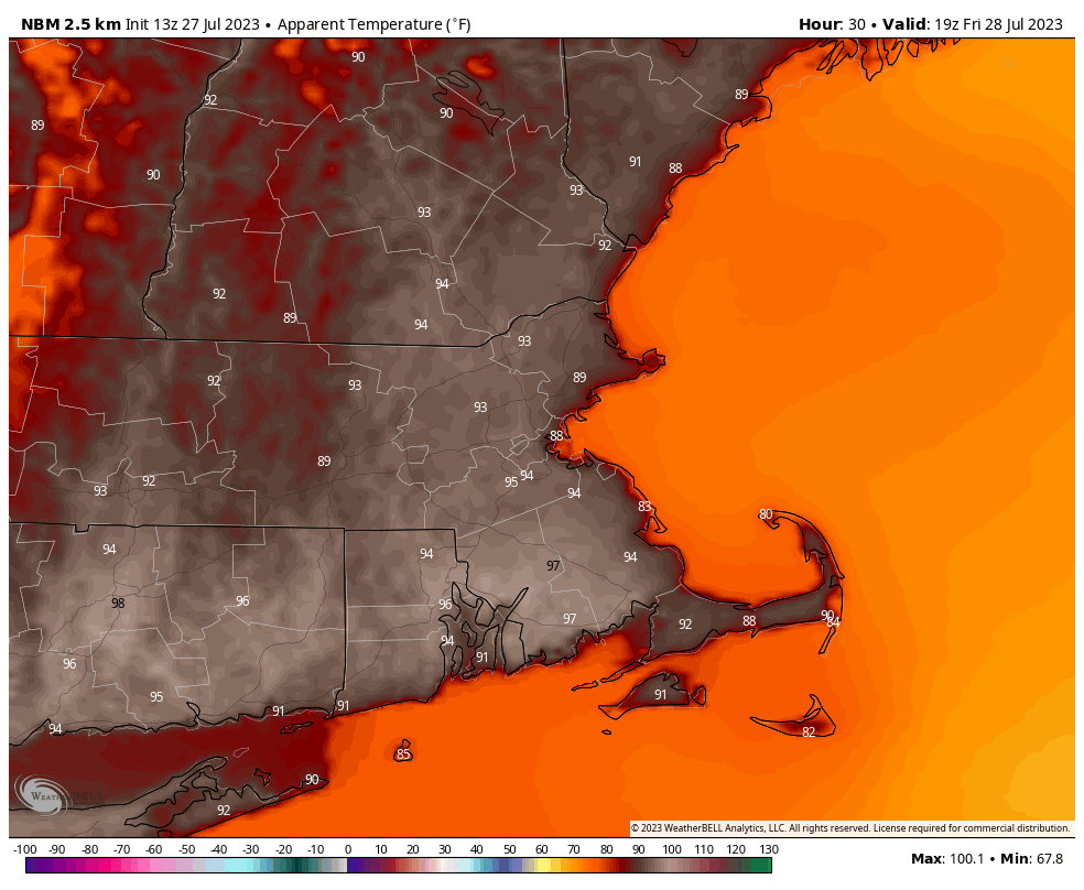
We’re starting things off on an active note, with a severe thunderstorm watch in effect for most of the region, except Cape Cod and the Islands, until 8pm. A vigorous upper-level disturbance is moving toward the region, and it has already triggered some showers and thunderstorms. They’ll become a bit more widespread as the afternoon wears on while moving generally eastward towards the area. Some of the stronger storms may produce hail, strong winds, heavy downpours that could lead to flash flooding, and possibly a tornado or two. With the potential for some heavy rain, a Flood Watch is also in effect for a good portion of the area. Activity should wind down and move offshore before midnight, leaving us with a warm and muggy night, with many spots not dropping below 70. Friday looks to be a very warm to hot day with moderate to high humidity for much of the region. High temperatures will likely approach or exceed 90 in many locations, except for the immediate South Coast. The combination of heat and humidity will send the heat index well into the 90s, so a Heat Advisory has also been issued. Friday night will be another warm and muggy night, leading into Saturday, which is the transition day.
Saturday will start off with some sunshine, along with very warm and humid conditions, but a strong cold front will be moving toward the region. Depending on how quickly the clouds move in, some spots could reach 90 by midday, especially south of the Mass Pike. We’ll have some showers and thunderstorms developing ahead of the front by early afternoon, and again, the threat is there for some severe weather, as well as heavy rainfall, so Flood Watches will likely be issued once again. Showers and storms end with the passage of the cold front at night, then a much cooler and drier airmass settles in for Sunday and Monday. Dewpoints will drop into the 50s, and temperatures will only be in the upper 70s and lower 80s for highs both days. With night time lows dropping into the 50s in many spots Sunday night, you’ll be able to turn off the air conditioner and open the windows in your dwelling. This airmass may hang around for a good chunk of the week, with one model showing the potential for a few spots to drop into the upper 40s Wednesday morning. We’ll have a closer look at that in our Weekly Outlook early Monday morning.

Thursday night: Showers and thunderstorms, some strong to severe during the evening, ending by midnight, then skies clear out. Low 67-74.
Friday: Sunny, hot, and fairly humid. High 86-93.
Friday night: Clear skies, clouds start to filter in late at night. Low 68-75.
Saturday: Some morning sun, then becoming mostly cloudy with showers and thunderstorms developing by early afternoon, some could be strong. High 84-91.
Saturday night: Showers and thunderstorms end during the evening, some clearing late at night. Low 60-67.
Sunday: A mix of sun and clouds. High 74-81.
Sunday night: Clear to partly cloudy. Low 56-63.
Monday: Sunshine and a few clouds. High 75-82.
