This week’s forecast is fairly simple, because we’re stuck in the same weather pattern that we’ve been in for quite some time.
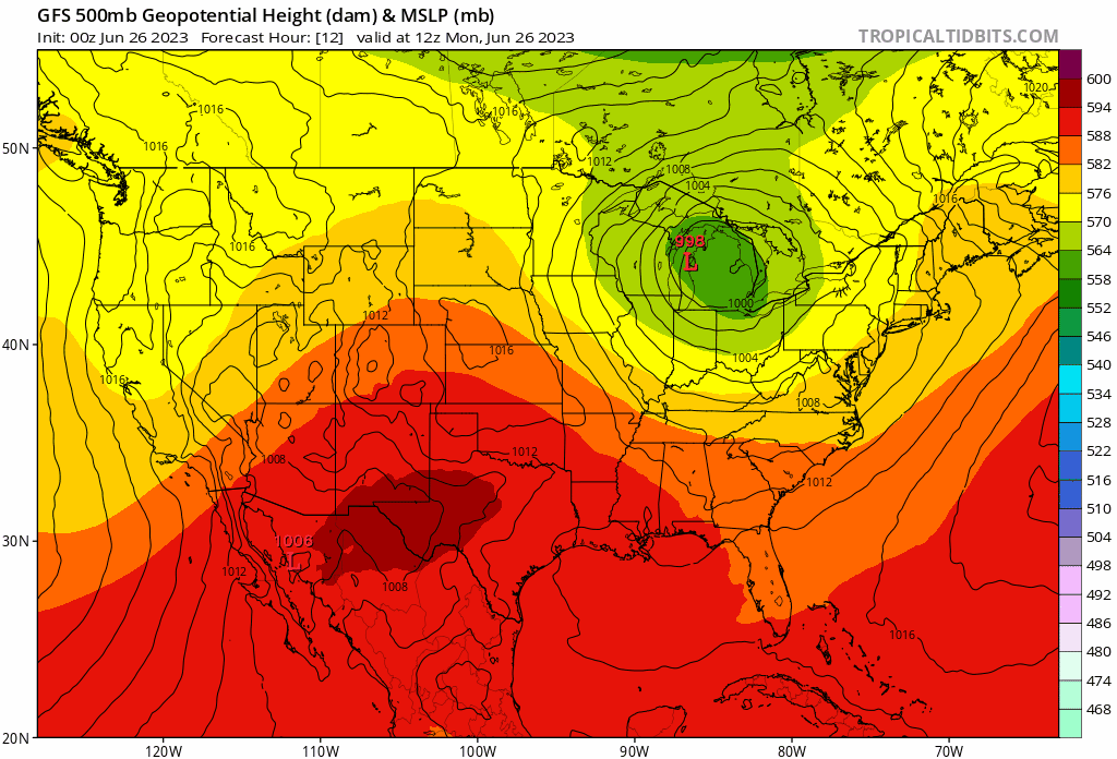
Upper-level low pressure over the Great Lakes will very slowly move eastward this week while weakening. As disturbances rotate around this low, we’ll have a daily chance for showers and thunderstorms, mainly during the afternoon and evening each day. Not everyone will get these, and none of the days will be a washout, but the threat exists each day for some showers and thunderstorms. Any storms that do form will likely produce heavy downpours, as we’ll have a warm and humid airmass in place. A few strong to severe storms are possible, especially today, but for the most part, we’re just looking at your typical garden-variety thunderstorms each day. The upper low finally starts to move out next weekend, but another one drops right into the Great Lakes in its place, keeping the unsettled weather going for a few more days.

Monday: Morning fog, then intervals of clouds and sun with showers and thunderstorms developing, some could be quite strong. High 77-84, a little cooler along the coast from the North Shore to the New Hampshire Seacoast.
Monday night: Mostly cloudy, fog redevelops, a few more showers, mainly during the evening. Low 62-69.
Tuesday: Partly to mostly cloudy, breezy with some afternoon showers and thunderstorms. High 72-79.
Tuesday night: Mostly cloudy, showers taper off in the evening, fog likely again. Low 62-69.
Wednesday: Intervals of clouds and sun, breezy, chance for a few afternoon showers and thunderstorms. High 73-80.
Thursday: Partly sunny, some showers and thunderstorms likely in the afternoon. High 74-81.
Friday: Partly sunny, an isolated shower or thunderstorm possible. High 73-80.
Saturday: Intervals of clouds and sun, breezy, chance for an afternoon shower or thunderstorm. High 76-83.
Sunday: More clouds than sun, breezy, more showers and thunderstorms possible. High 74-81.
