We’ve got good news and bad news. Good news: the 4-day period this forecast encompasses won’t be half bad. Bad news: the 4-day period this forecast encompasses will be half bad.
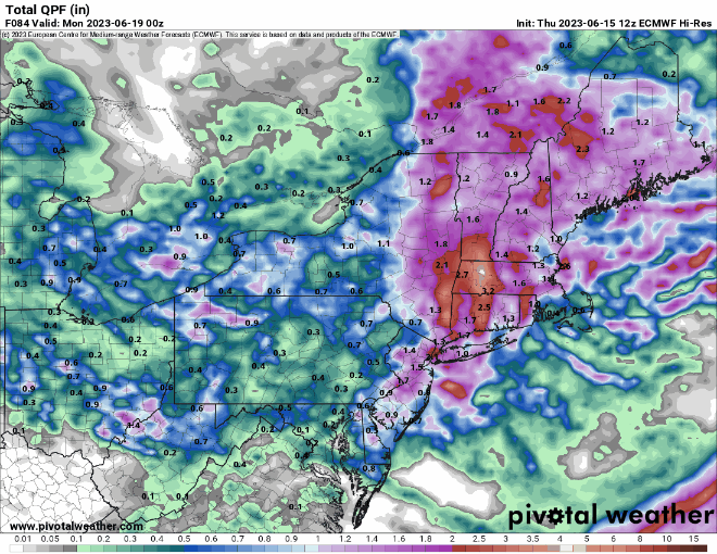
We start off with high pressure in control tonight and early Friday with dry and seasonably mild conditions. Low pressure sends a warm front our way on Friday, with more clouds in the afternoon along with more humid air, and eventually, some showers and thunderstorms by evening. The low pressure system will take it’s time moving across the region as it will be accompanied by yet another upper-level low, which means Saturday will feature occasional showers and thunderstorms and cooler temperatures. The showers will likely continue into early Sunday before tapering off, but with the low only slowly departing, clouds will remain for much of the day. We should see some improvement on Monday, but with that upper-level low nearby, we could see a few pop-up showers in the afternoon.
Thursday night: Clear skies. Low 56-63.
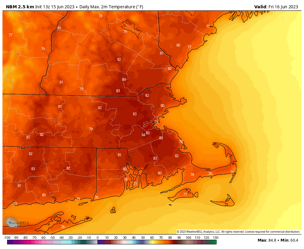
Friday: Sunshine in the morning then clouds start to increase along with humidity levels, showers and thunderstorms possible by evening. High 77-84.
Friday night: Scattered showers and thunderstorms. Low 56-63.
Saturday: Cloudy with occasional showers and some bouts of steadier rain, a few thunderstorms possible as well. High 62-69.
Saturday night: Plenty of clouds with a few more showers likely. Low 52-59.
Sunday: Showers taper off in the morning, mostly cloudy in the afternoon with a few breaks of sun possible. High 63-70.
Sunday night: Partly to mostly cloudy. Low 51-58.
Monday: Partly sunny, a shower is possible during the afternoon. High 66-73.
